
The United Nations voted 164–1 to urge wider use of a world map that shows Africa at its true scale—and that single digit says more about global politics than cartography.
At a Glance
- The United Nations backed promoting the Equal Earth projection in schools and public use.
- Togo led the push on behalf of African states, with African Union support.
- The measure is nonbinding and does not ban the Mercator projection.
- The United States cast the lone “no,” calling it an ideological distraction.
What The United Nations Actually Voted For
The General Assembly approved a resolution that promotes equal-area world maps, notably the Equal Earth projection, to correct size distortions common in classroom and media maps. The text urges publishers and education ministries to show land areas at true scale. It does not outlaw the Mercator projection or set a legal mandate. It signals that when teaching geography or showing a world overview, equal-area maps should be the norm, not the exception.
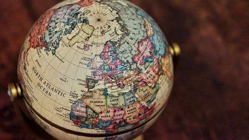
Backers framed the move as a basic accuracy fix. The Mercator projection, designed for navigation, stretches lands near the poles and shrinks those near the equator. That makes Greenland and Europe look huge, while Africa looks smaller than it is. Equal Earth keeps areas proportional, so Africa, at over 30 million square kilometers, appears as large as it truly is relative to Canada and Russia. This is not new science; it is choosing the right tool for the display job.
Who Pushed It And Why Africa Is Center Stage
Togo introduced the measure for the African Group, with support from the African Union. Supporters said maps shape how people see power and place. If a continent looks small on the wall, people may assume it matters less. That claim is more cultural than technical, but it resonates in classrooms and newsrooms worldwide. The resolution labels Equal Earth “a relevant option” to improve accuracy for general use, which is a narrow, practical goal rather than a revolution.
Conservatives should welcome accuracy and straight talk. A world map for navigation is not the same as a world map for civics class. The International Cartographic Association advises against using Mercator as the default for world displays because it distorts area at global scale. Keeping Mercator for ships and planes makes sense. Switching to equal-area maps for teaching land size also makes sense. Tools should fit their tasks. That is not ideology. That is common sense.
Why The Lone “No” From The United States Matters
The United States delegation argued the resolution pushed an ideological agenda and distracted from real security and economic problems. The statement warned the measure tied into talk of reparations and “cognitive justice,” and said such debates hurt the United Nations’ credibility. That is a political critique, not a cartographic one. If the text had forced a ban, the alarm would track. But the measure is nonbinding and focused on education and general use, not navigation.
The UN General Assembly has voted to adopt a new world map projection that shows the size of Africa and other continents more accurately.
The “Correct The Map” resolution, sponsored by Togo and backed by African Union member states, received support from 164 countries. The… pic.twitter.com/tDuDLYWVtK
— Ⓝⓖ'ⓞⓡⓞⓡⓘⓔⓣ🐐🇰🇪 (@baroswahjr) September 5, 2026
On the merits, the United States would have been stronger by separating two ideas. First, say yes to accurate, task-fit maps for teaching. Second, say no to any attempt to turn maps into moral lectures. That line would protect classrooms from activism while keeping the globe in proper proportion. Instead, a full “no” let critics frame America as defending an old distortion. That is poor optics in a debate where the facts on distortion are easy to show on a poster.
What Changes Next In Classrooms And Media
The resolution is a nudge, not a switch. Publishers, ministries, and software teams decide what happens. Expect more atlases and school posters to move to Equal Earth or other equal-area options. Expect news graphics to follow when stories need fair comparisons of land size. Do not expect pilots or captains to use Equal Earth. Mercator and other conformal tools still rule for routes. One size does not fit all, and the text allows for that balance.
The wiser downstream play is pluralism with clarity. Label the projection. State what it preserves: area, shape, or distance. Teach students why no flat map can keep everything true at once. Then pick the right map for the job. That approach cuts the culture war out of the classroom and keeps accuracy at the center—an outcome both parents and taxpayers prefer.
The Bottom Line
The United Nations vote is best read as an update to default settings, not a redraw of the world. Africa will look like the land giant it is. Europe and North America will look smaller than many of us remember from school. Navigation stays the same. Education gets closer to the truth in area. That mix honors technical facts, keeps politics in check, and helps students see the world as it is, not as a 16th-century wall map once suggested.
Sources:
diplomacyandlaw.com, newscord.org, english.aawsat.com, en.wikipedia.org, ctvnews.ca, thenationalnews.com
© targetliberty.org 2026. All rights reserved.